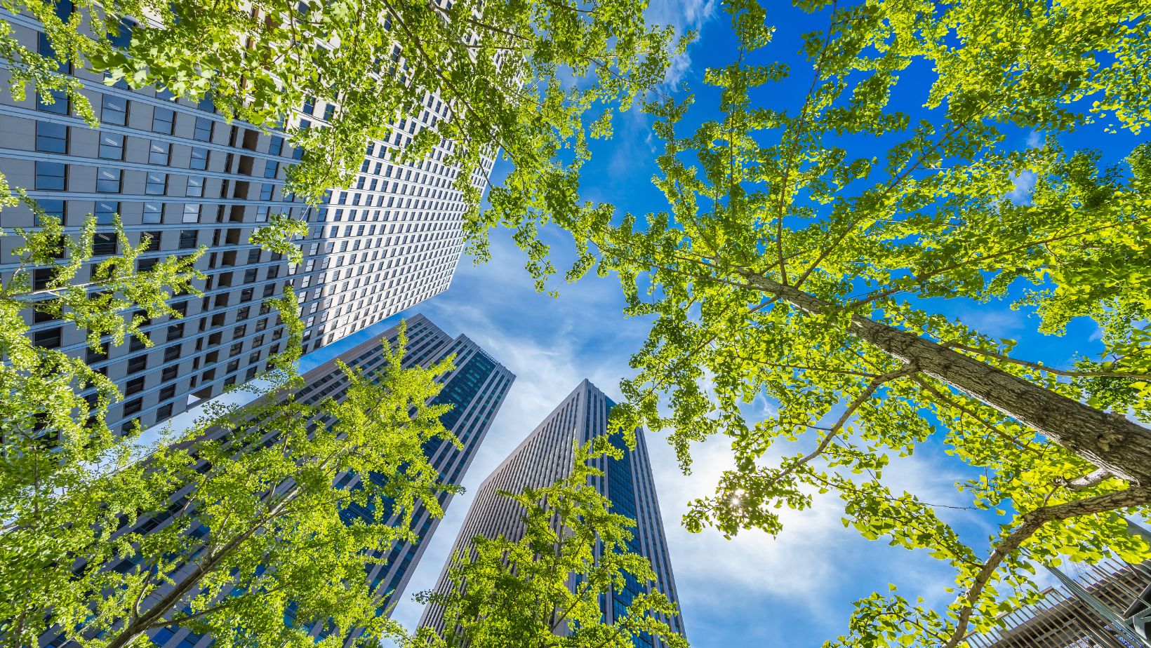
Urban green spaces have become the lungs of modern cities, breathing life into concrete jungles and offering residents a much-needed escape from the daily grind. From pocket parks tucked between buildings to sprawling botanical gardens these verdant oases play a crucial role in maintaining urban biodiversity and promoting public health.
In today’s rapidly expanding metropolises the question of how many green spaces exist isn’t just about counting trees – it’s about understanding the delicate balance between development and nature. Cities worldwide are embracing the “green revolution” transforming abandoned lots rooftops and even railway lines into thriving natural habitats. It’s fascinating to see how urban planners and environmentalists are working together to create these green sanctuaries while maintaining the city’s essential functions.
How Many Urban Green Spaces Fill the City?
Urban green spaces encompass various natural and semi-natural areas within city limits that provide ecological benefits while enhancing community well-being.
Types of Green Spaces in Cities
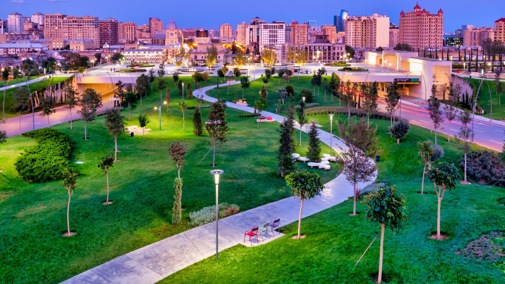
Cities incorporate diverse categories of green spaces that serve multiple functions. Public parks offer recreational areas with walking paths, playgrounds and sports facilities. Urban forests create dense tree canopies along streets and in preserved woodland areas. Community gardens transform vacant lots into productive spaces for growing food and flowers. Pocket parks utilize small parcels between buildings to create micro-oases with benches and plantings. Green roofs convert building tops into vegetated spaces that absorb stormwater and reduce energy costs. Greenways connect different neighborhoods through linear corridors of trees and native plants. Rain gardens capture runoff in landscaped depressions filled with water-tolerant vegetation.
Measuring Urban Green Coverage
Satellite imagery and GIS mapping tools quantify the percentage of urban land dedicated to green spaces. Modern cities aim for 30-40% green coverage based on World Health Organization recommendations. Tree canopy assessments track the extent of urban forest coverage through aerial surveys. Park accessibility metrics evaluate the distribution of green spaces by measuring walking distances from residential areas. Green space per capita calculations determine the square footage of parks and natural areas available per resident. High-resolution remote sensing identifies specific vegetation types and monitors changes in green coverage over time. Digital mapping platforms create detailed inventories of both public and private green assets.
Distribution of Green Spaces Across City Zones
Urban green spaces follow distinct patterns across different city zones, creating a network of natural areas that serve specific neighborhood needs. The distribution varies based on population density, land availability and historical urban development patterns.
Downtown Green Areas
 Downtown districts incorporate compact green spaces designed for high-density usage. Central business districts feature pocket parks measuring 100-500 square meters, strategically placed every 3-4 blocks to provide accessible recreation spots. Rooftop gardens occupy 15-20% of available building surfaces in city centers, adding 2-3 hectares of elevated green space per square kilometer. Linear parks along former railway lines connect these spaces, creating green corridors that span 2-5 kilometers through urban cores.
Suburban Parks and Gardens
Suburban zones contain larger expanses of green space, with community parks averaging 5-10 hectares each. Residential areas maintain a 40% green coverage ratio through combinations of public parks, private gardens and street trees. Nature preserves ring suburban boundaries, providing 15-20 hectare buffer zones between developed areas and natural landscapes. Community gardens occupy vacant lots, converting 200-400 square meters of space into productive green areas that serve local residents.
Quantifying Green Space Coverage
Urban green space measurement relies on standardized metrics to assess environmental quality across cities. These measurements enable city planners to make data-driven decisions about green infrastructure development.
Standard Metrics and Calculations
The Green Space Index (GSI) calculates the ratio of vegetated areas to total city area using remote sensing data. Modern analysis tools combine satellite imagery with ground-level surveys to achieve 95% accuracy in green space identification. Key measurement metrics include:
- Canopy coverage percentage measured through LiDAR scanning
- Green space per capita expressed in square meters per resident
- Park accessibility radius mapped in 10-minute walking distances
- Vegetation density index tracked through normalized difference vegetation index (NDVI)
The following table shows standard green space metrics:
| Metric | Measurement Method | Typical Range |
|---|---|---|
| Canopy Cover | LiDAR/Aerial imagery | 20-35% |
| Green Space per Capita | GIS Analysis | 9-50 m² |
| Park Access | Network Analysis | 400-800m |
| NDVI | Satellite Data | 0.2-0.8 |
Global Benchmarks for Urban Greenery
International standards establish targets for urban green coverage based on population density. Singapore leads global rankings with 47% green coverage through vertical gardens integrated into architecture. European cities maintain:
- Copenhagen: 42% green space coverage
- Amsterdam: 38% public green areas
- Vienna: 45.5% protected green zones
- Stockholm: 40% biodiverse spaces
- Minimum 15m² green space per resident
- 30% tree canopy coverage in developed areas
- Green corridors every 2km in dense urban zones
- Accessible parks within 300m of residential areas
Benefits of Urban Green Space Density
Dense urban green spaces create measurable improvements in city environments through enhanced ecosystem services and community engagement. These benefits manifest in multiple ways across environmental and social dimensions.
Environmental Impact
Dense urban green spaces reduce city temperatures by 2-8°C through evaporative cooling and shade provision. Tree canopies in concentrated areas filter 85% of particulate matter from surrounding air while absorbing 150kg of CO2 annually per mature tree. Connected green networks improve biodiversity by creating wildlife corridors that support 15-20 native species per hectare. Urban forests with 40% or greater density decrease stormwater runoff by 65% through natural filtration processes. Green space clusters also minimize the urban heat island effect by reducing ground surface temperatures up to 15°C compared to non-vegetated areas.
Community Wellbeing
Dense green spaces within 300 meters of residential areas increase physical activity levels by 48% among local residents. Communities with abundant parks report 30% lower stress levels compared to areas lacking green spaces. Property values rise 20% when located adjacent to well-maintained urban parks. Crime rates decrease by 15% in neighborhoods with dense tree coverage and maintained green spaces. Access to community gardens strengthens social bonds, with participants reporting 65% more neighborhood connections than non-participants. Urban areas with high green space density experience 40% fewer mental health-related hospital visits compared to areas with minimal green coverage.
Challenges in Expanding Urban Green Spaces
Cities face significant obstacles in creating new green spaces despite their proven benefits for environmental quality and public health. The expansion of urban greenery encounters several critical barriers that require strategic solutions and careful planning.
Space Limitations
Dense urban environments present severe constraints for establishing new green spaces. Existing infrastructure occupies 85% of available land in city centers, leaving limited room for parks or gardens. Competition for real estate drives land prices up to $1,000 per square foot in prime urban locations, making green space acquisition financially challenging. Underground utilities, building foundations, and transportation networks restrict potential planting areas by 60%. Creative solutions like vertical gardens, green roofs, and pocket parks maximize limited space, transforming 25% of unused vertical surfaces into green areas.
Urban green spaces require continuous care to remain functional and attractive. Annual maintenance costs average $5,000 per acre for basic upkeep, including irrigation, pruning, and waste management. Water consumption demands 2-3 gallons per square foot during peak growing seasons. Professional landscaping teams dedicate 20 hours per week per acre for essential tasks like mowing, weeding, and plant health monitoring. Specialized equipment maintenance adds $2,500 yearly per maintenance vehicle. Weather damage restoration consumes 15% of maintenance budgets, while pest control requires quarterly treatments at $800 per acre.
Future Planning for Urban Green Spaces
Future urban green space planning integrates technological innovations with sustainable development principles to create resilient city ecosystems. Modern urban planning emphasizes the creation of interconnected green networks that serve multiple environmental functions.
Smart City Integration
Smart sensors monitor soil moisture levels green space usage patterns. IoT devices track air quality improvements near urban forests providing real-time data to city planners. Digital platforms enable automated irrigation systems reducing water consumption by 40%. Artificial intelligence analyzes vegetation health patterns identifying areas needing immediate attention. Mobile applications connect residents with nearby green spaces displaying real-time occupancy information. Environmental monitoring stations measure temperature variations between green spaces urban heat islands documenting cooling effects of up to 8°C. GPS-enabled tree inventory systems track urban forest growth maintenance needs across city zones.
Sustainable Development Goals
Urban green spaces align with UN SDG 11 focusing on sustainable cities communities. Cities implement 15-minute accessibility plans ensuring green space access within walking distance. Environmental justice initiatives target 40% tree canopy coverage in underserved neighborhoods. Green infrastructure projects reduce urban flooding by 65% through permeable surfaces rain gardens. Carbon reduction strategies incorporate urban forests capable of sequestering 48.3 tons of CO2 annually per hectare. Biodiversity programs establish wildlife corridors connecting fragmented habitats across urban landscapes. Local food security improves through community gardens producing 12kg of fresh produce per square meter annually.
Maintenance Considerations
Urban green spaces have revolutionized modern city planning by creating vibrant ecosystems that benefit both residents and the environment. Through innovative approaches like vertical gardens pocket parks and smart technology cities worldwide are meeting ambitious green coverage targets.
The future of urban development lies in the strategic integration of these green sanctuaries. With cities like Singapore leading the way achieving impressive coverage rates and implementing creative solutions other metropolitan areas now have clear blueprints for success.
As cities continue to expand the role of urban green spaces will become even more crucial in building sustainable resilient communities. These natural havens aren’t just amenities – they’re essential components of thriving urban ecosystems that support public health environmental stability and community well-being.